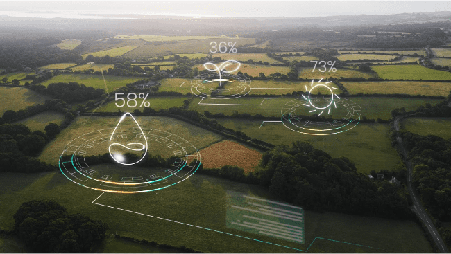
Farmers rarely lack data. Every day, they deal with soil samples, weather apps, machinery logs, scouting notes. Field notes highlight some deviations, yield maps cover last years, but this information doesn’t always line up in time or scale. Satellites, which show every part of the field in the same frame, again and again, fill that gap.
A satellite-based crop growth monitoring system doesn’t just collect images. It turns them into consistent measures that link with other farm records. Instead of separate fragments, growers get one field view that helps plan inputs and detect issues early.
Types Of Data Satellites For Agricultural Monitoring
Farm monitoring depends on seeing fields from many angles. Satellites act like different lenses, providing those angles and revealing information about crops, soil, water content, weather, etc. that together create a field overview. The main types of satellite data used in agriculture are:
- Multi- and hyperspectral. Capturing several light bands, from visible to infrared, allows for calculating indices like NDVI to track plant vigor and nutrient status. Sentinel-2 and Landsat 8 are widely used for this purpose.
- Optical. Provide sharp images in visible light, making it easier to identify irregular zones and compare crop cover.
- SAR (Synthetic Aperture Radar). Radar penetrates clouds and works day or night. SAR satellites, such as Sentinel-1, support soil moisture monitoring and crop structure analysis during cloudy seasons or in regions with frequent cloud cover.
- Thermal. Detect canopy temperature changes linked to water stress, guiding irrigation before plants show visible decline.
- Soil moisture. Specialized satellites, such as NASA’s SMAP, directly measure soil water content for better irrigation planning.
Of course, farmers can use one specific type of data. However, the larger your farm and the higher your product quality criteria, the more sense it makes to mix various types of data based on local conditions and needs.
Applications Of Satellite Data In Modern Farming
Because satellite data offers information on numerous elements of agriculture, its uses are extremely diverse. In particular:
- Monitoring crop health through NDVI and other indices that show plant biomass and stress levels, helping target weak zones in a field.
- Soil mapping that combines imagery with on-ground testing to define soil texture, nutrient levels, and moisture for precise input use.
- Crop planning based on historical imagery to assess land suitability, plan rotations, and set realistic schedules.
- Irrigation management with data on evapotranspiration and soil water balance, ensuring water is applied efficiently.
- Pest and disease alerts where satellite imagery picks up early stress signals, guiding timely treatments.
- Yield forecasting using crop growth models, weather, and biomass data to estimate production before harvest.
In other words, satellite data can be more than just an abstract way of field observation; it can be a practical tool that allows farmers to know exactly how to distribute agricultural inputs, where crops are at risk, and how to maximize yields.
Turning Satellite Signals Into Agricultural Data
Modern agriculture is not short on data. But most often it is short on clarity. A single satellite pass generates millions of pixels, but only structured processing makes those pixels meaningful for a farmer. Two pillars drive this translation: vegetation indices and machine learning models.
- Vegetation indices are the simplest way satellites turn raw light into information about crops. The most common is NDVI, which compares red and near-infrared reflection to show whether plants are healthy or stressed. In dusty or cloudy regions, EVI improves accuracy by filtering atmospheric noise. GNDVI, based on leaf greenness, gives a closer look at photosynthetic activity and nutrient use. SAVI, in turn, reduces soil interference, making it useful in dry areas with sparse vegetation.
- Machine learning models can better interpret raw signals of vegetation indices. Models such as Random Forests or CNNs combine satellite and weather data to predict crop yields, detect stress at early stages, and classify crop conditions. Deep learning, in particular, extracts subtle patterns from images that human-designed methods often miss.
Vegetation indices, showing what happens in the field, and machine learning models, telling how to put this information into action, are a great combination for the modern, savvy farmer.
The Everyday Value Of Satellite Crop Monitoring
Satellite monitoring proves its worth in optimizing field inputs. Imagine planning irrigation during a hot week. Instead of relying on routine schedules, a grower can check updated satellite images, for example, three-meter detail arriving several times a week, as with EOSDA Crop Monitoring, and see which sections are already drying out and which are sufficiently moistened.
But efficiency is only half the story. Resilience grows from catching problems early. When satellite images reveal an unexpected change in vegetation, it can point to stress from pests, flooding, or fertilizer misplacement. Farmers gain extra days, sometimes weeks, to act and avoid yield loss.
Satellite technology is also becoming easier to connect with other tools. Modern platforms store data in the cloud, giving access through APIs and dashboards that can sync with on-farm IoT sensors. Some farms now combine satellites with drones: satellites scan the full acreage for trends, while drones zoom in to inspect specific rows. Together, they create a practical system where efficiency and resilience are not separate goals, but two sides of daily decision-making.
At the end of the day, remote agriculture monitoring gives something simple: timely field information. It can’t solve every problem, but highlights where attention is needed most. It’s a way to reduce guesswork and make daily farm decisions more confidently.
Vasyl Cherlinka is a Doctor of Biosciences specializing in pedology (soil science), with 30 years of experience in the field. With a degree in agrochemistry, agronomy, and soil science, Dr. Cherlinka has been advising the private sector on these issues for many years.


