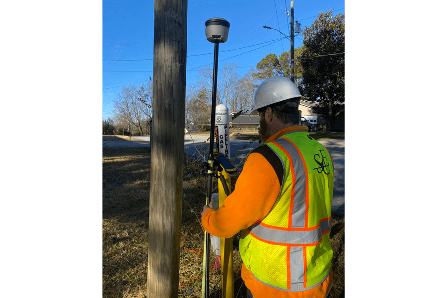
Every year, when thousands of new gas pipelines are installed, field engineers must record data on the pipeline components, including the pipe segments, connections, asset type, pressure tolerance and personnel. Details down to individual welds are captured and entered into a GIS database to support utility operations and asset management. In many cases, the data must be recorded before a pipeline is buried. Utilities use the data to identify pipes in the field with potential problems. Global navigation satellite system (GNSS) technology has become the go-to for collecting this data quickly and accurately.
GNSS refers to a constellation of satellites that transmit positioning, navigation and timing data to GNSS receivers. The receivers use this data to determine a location. GNSS improves the accuracy of the location, which ultimately saves time and money.
The data collected by the engineers supports utility operations and asset management and can be shared with other utilities and public agencies as needed. Utilities can use the collected data to find pipes in the field quickly to prevent issues.
Suburban Consulting Engineers, Inc., (SCE) regularly works with gas utility companies and, out of necessity, has developed an enhanced GIS system that is compatible with other geospatial systems to support the collection of detailed asset information required by gas utilities and regulatory agencies.
To meet requirements for traceability, SCE developed high-efficiency techniques to collect live as-builts of their clients’ pipelines. The work meets Pipeline and Hazardous Materials Safety Administration (PHMSA) requirements.
As part of its process, SCE uses the Esri GIS platform to provide a consistent geospatial framework to record the detailed information. A custom library of forms for each gas utility client’s data collection enables field engineers to work with standard workflows while capturing asset information. They use GNSS receivers (in this case, Trimble R2 with TDC handheld data collectors running on Esri Collector software) to capture the locations and geotagged images. In some cases, they use a GNSS network built on VRS technology.
The GNSS receivers provide pinpoint positional accuracy down to centimeter-level, so technicians are confident in the location of data. By using the large capacity data storage feature in the handheld data collector, they can maintain large spatial databases which can store information and location tagged images. For each project, the collected data is transitioned to an Esri geodatabase where they perform quality assurance (QA) and quality control (QC) for connectivity between pipeline sections and consistent attribution. That data is fully traceable, verifiable and provides a complete record for the life of the assets, in accordance with the PHMSA regulations.
The company’s GIS technicians no longer need to model or translate data since each client can see a full digital twin of its pipeline, customized to each client’s existing schema and formats, and updated weekly.
Jacob McGlincy, GIS supervisor at Southern Company Gas, immediately saw the benefits of using GNSS with GIS. At the end of a new pipeline project, he was asked to find all the pipe segments installed on a transmission pipeline project that were manufactured on a specific day, had a specific type of coating and had a field bend. “It took five minutes to query our data and identify seven pipe segments from more than 1,100 that had been installed, together with their exact locations in the field,” McGlincy says. The seven segments were verified, and the pipeline was commissioned on time. “Without real-time access to the data, this research could have taken days or weeks with many exploratory digs to find and verify these segments,” he says.
Using GNSS, companies are also reducing labor costs. Data collection is used more during pipeline construction since only one day of information is needed to provide the enhanced data into a different GIS. In the past, this data could not have been captured with the same degree of precision. “What started as simple pipeline feature collection is now moving to material collection,” says Marc Sheridan, natural gas GIS department manager at SCE. Inspection reports are going digital and soon inspections and close-out packages will provide complete pipeline documentation.
Headline photo courtesy of Suburban Consulting Engineers. Using GNSS reduces labor costs since data is collected during pipeline construction and only requires only one day.
Nicholas Duggan is a chartered geographer and writer with several decades of experience creating geospatial solutions in national mapping agencies, renewables (offshore and onshore), nuclear, proptech, 3D and 4D using many different GIS and web mapping platforms.


