

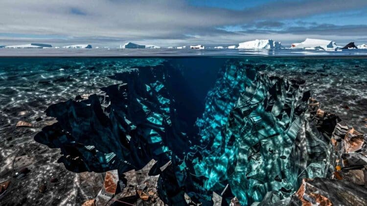

Beneath the freezing Antarctic seas lies a hidden world. It remains completely missing from everyday maps.
This vast terrain features deep valleys and branching underwater channels.
Science is finally starting to see it clearly. A new catalog has changed our entire understanding of the region. It uses the sharpest seafloor imagery ever recorded down there.

Scientists identified 332 massive submarine canyon networks. Some drop over 13,000 feet into the deep ocean.
What happens when the very channels shaping our oceans are invisible to the tools we use to predict the future?
A hidden world five times larger than expected
The new map relies on the International Bathymetric Chart of the Southern Ocean. Experts call this the most complete map ever made of the region.
This hidden world has eluded cartographers for centuries. In fact, ever since 1513—the year the famous Piri Reis map was drawn—these deep-sea features have remained entirely invisible.
Naturally, these newly discovered canyons didn’t appear on that ancient parchment, nor have they appeared on any map drawn in the half-millennium since. Until now.
The resolution captures details at about 1,640 feet per pixel. That is four times sharper than any previous map.
This high quality changed the game for marine researchers.
David Amblàs and Riccardo Arosio used advanced software to scan the rugged terrain. Coarse maps from the past made this kind of automation unreliable.
Now we have clear proof of 332 distinct canyon networks. Many drop down more than two and a half miles. That’s five times more canyons than previously documented.
Why polar canyons grow so large
Antarctic canyons do not just beat records in total numbers. They are also absolutely massive in physical size.
Amblàs explains that these structures are much deeper than canyons elsewhere.
The main force shaping them is a turbidity current. Think of these as underwater avalanches of mud and sand. They rush down steep slopes at high speeds and violently erode the seafloor.
Antarctica’s steep drops make these underwater avalanches incredibly powerful.
Right now, scientists know of roughly 10,000 submarine canyons worldwide. However, we have only mapped about 27% of the global ocean floor.
The true number is likely much higher.
The researchers built a specialized tool using geographic information systems. It calculates 15 different shape measurements with a few clicks, allowing for systematic analysis for the first time.
East vs. West: Two very different canyon worlds
The study revealed a fascinating geographical contrast. The canyons in East Antarctica look completely different from the ones in West Antarctica.
Nobody had ever formally described this structural difference before.
East Antarctic canyons are complex, branching systems. They feature wide, U-shaped valleys with many paths. They usually start near the shelf edge and merge into one channel.
This shape points to a long history under heavy glacial ice, where erosion and heavy sediment piles shaped them over eons.
West Antarctic canyons tell a totally different story. They are much shorter and significantly steeper. They also have sharp, V-shaped profiles.
This indicates they are younger or eroding at a faster rate.
Arosio points out that this physical difference supports a major theory. Scientists believe the East Antarctic Ice Sheet formed much earlier than the western sheet.
Old sediment samples from the ocean floor hinted at this for years.
Seafloor maps finally provide the clear physical proof.
The climate connection hiding in the deep
These giant canyons are not just dead pieces of rock. They actively alter the ocean water moving around them. Because of that, they directly impact global weather patterns.
Freezing, heavy saltwater forms near the giant floating ice shelves. This dense water plunges down through the canyons.
It rushes off the continental shelf into the deep ocean.
Scientists call this heavy water mass Antarctic Bottom Water. It acts as a primary engine for global ocean circulation. It pushes heat and fresh oxygen across every ocean basin.
But these same channels create a two-way street. They also pull warmer water from the deep ocean back toward the coast.
This warm current is known as Circumpolar Deep Water. It flows upward and melts the bottom of floating ice shelves.
When the shelves thin out, land glaciers slide into the sea much faster. This process directly pushes global sea levels higher.
A gap in the models—and a call to act
Here is the catch that changes everything.
These massive canyon systems are completely missing from our climate projections. Our current computer models do not see them. Even advanced models used for international climate assessments overlook them entirely.
Without this data, we cannot accurately predict how the ocean will behave.
It limits our ability to forecast future climate shifts.
Amblàs and Arosio are urging the scientific community to take action immediately. We desperately need high-resolution mapping in the remaining blank spots.
Scientists must collect real-world data directly from the deep sea.
We have to update our global climate models to include these physical forces. What happens at the bottom of the world is no longer just an interesting science fact.
It is the crucial missing piece of the puzzle, and it dictates how accurately we can predict the future of our own planet.

Kelly is an experienced writer with 15 years of experience exploring the big stories that shape our world, from tech breakthroughs and space exploration to climate, energy, and the fascinating quirks of science. She has a talent for turning complex ideas into sharp, memorable insights that stay with readers long after they’ve finished reading.